If you're hearing the call of the great outdoors, give in. Great is not often associated with it for nothing. But I have to tell you early on that it's not just about seeing breathtaking views and cool winds caressing your face. There's a lot of physical and mental challenges involved - sore muscles, agonizingly steep and slippery trails, itchy plants, mud, blistering sun and all those discomforts associated with communing with nature.
With these realities, ample preparation must be undertaken to maximize your hiking experience, avoid accidents and to ensure your safe return. Work on your endurance by running, playing other sports, climb several flights of stairs with a backpack, learn about the place you're going so you can bring adequate supplies and equipment, and always let someone know of your whereabouts. Lastly, when you go to the mountains, leave no trace behind. All garbage must go back down with you.
Now, the fun part. Here are five hiking trails around Luzon to get you started. I've tried each trail and can attest that it will offer a good sweat, minimal panting for the physically prepared and of course - eye-popping views. All can be completed within a day - out and back.
 |
| Taken at the ranch in Mt Ampacao, from here, the summit is 30 minutes away |
Height : 438 MASL (Meters Above Sea Level)
One of the nearest hiking destinations near Manila is Mt. Tagapo, which is only 3.5 hours away if taking public transportation. The jump-off at Barangay Janosa in Binaganon is accessible by riding a public boat from Binagonan Port that cruises over the scenic Laguna de Bay, passing islets and other barangays beside the lake. Hiking to the summit takes 2-3 hours. Expect a rocky trail at the start and a gradual ascent for majority of the way up. Don't forget to bring a cap and other protection from the sun as some parts of the trails have no forest cover.
 |
| Taken at the Summit of Mt. Tagapo |
2. Mt. Lobo (Lobo, Batangas)
Height : 710 MASL (Nagpatong Peak); 670 MASL (Bangkalan Peak)
Though the arduous commute to its jump-off has made it less popular to hikers coming from Manila, (around 4 hours of shuffling over various modes of transportation), its cool, forest trail that passes several streams has made it a worthwhile destination. Its two prominent peaks, Nagpatong and Bangkalan are separated by a fork. The latter is more frequented by hikers, has a bigger campsite and takes 3-4 hours to get to, while Nagpatong peak takes 30 minutes longer. From any of the two peaks, views of other mountains in Batangas, Quezon and Laguna are visible. Verde island passage, which hosts the greatest number of shorefish species in the world, can also be seen from its summit.
View full post here : http://www.jovialwanderer.com/2013/01/mt-lobo-batangas.html
 |
| The trail of Mt Lobo involves crossing several streams at the early part of the hike |
Height : Unknown
This peak located in the Philippines' wood carving capital turns into a pilgrimage spot during the Holy Week. The concrete trail located in the middle of a forest starts at Barangay Ilaya Norte amidst a small community of chatty locals. The steps are established but quite steep and takes 40 minutes to get to its peak which is marked with three white crosses. Views of Laguna Bay and the rest of the town can be seen. Worthwhile sidetrips after the short hike are Matabungka Falls which is located near the trail to the peak, centuries-old Paete church and Kape Kesada, an art gallery cafe showcasing works of local artists.
 |
| View from the peak of Tatlong Krus |
Height : 1,889 MASL
A cool 90-minute hike that starts near Ambasing Elementary school offers an ascending trail on thin air that's abundant with pine trees, views of the town of Sagada and nearby mountains in Ilocus Sur and Mountain Province. A traverse to Lake Danum can be done to catch a glorious sunset, a famed attraction in the congenial town of Sagada.
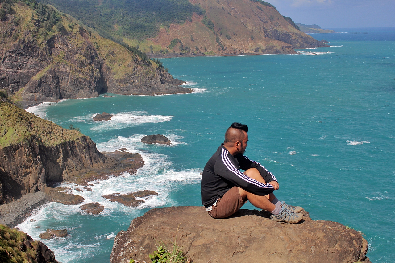
*see first image*
*see first image*
5. Mt. Timbac (Atok, Benguet)
Height : 2,717+ MASL
It's the 3rd highest point in Luzon after Mt. Tabayoc and Pulag. The trails are mostly on a concrete road while some parts are rocky. You won’t really need hiking shoes here, just a shoe with a good traction. It starts at a hilly portion of the road where you can find yourself catching your breath on the first 30 minutes as you're already at a high altitude where air is thinner. Popular jump-off is at KM. 55 of Halsema Highway which can be reached by riding one of the buses to Bontoc or Sagada from the terminal in Baguio near the slaughter house. First trip from Baguio is at 6:30 am.
 |
| Trail almost concealed by the fog as I start my ascend Mt Timbak's peak |
For more information on Philippine hiking trails, check out pinoymountaineer.com

About the Author :
Christine Fernandez has been an avid hiker since 1999. She has permanently abandoned her childhood dreams of becoming a ballerina and has opted to flash her flexibility in navigating around mountain trails. Read more about her backpacking and hiking adventures at www.jovialwanderer.com or follow her on Twitter : @jovialwanderer